
Guides · Cycling in Taiwan
Wuling Hehuanshan Cycling|Taiwan's Highest Road, 3,275m
Wuling, at 3,275 meters above sea level, is the highest point on the paved road network of Taiwan. And a bucket-list climb for cyclists worldwide. The west route begins around 450 meters in Puli, Nantou; the east route starts near sea level on the Pacific coast of Hualien and follows the official Taiwan KOM Challenge course. Both finish above 3,000 meters. This guide covers the routes, climbing difficulty, altitude precautions, and road closures, drawing on official and semi-official sources for riders planning this challenge.
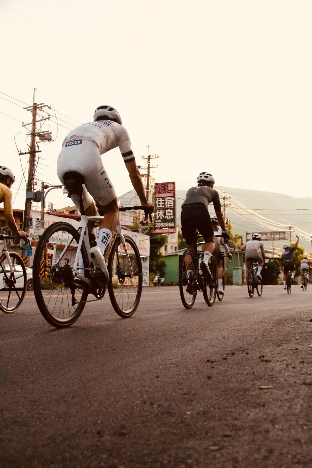
What Is Wuling, and Why Cyclists Chase It
Wuling stands 3,275 meters above sea level, on Provincial Highway 14A around the 31.5 km mark, right at the western edge of Taroko National Park, administratively part of Ren-ai Township, Nantou County. It is the only stretch of the official road network of Taiwan above 3,000 meters. A title confirmed by both the Tourism Administration and the Directorate General of Highways, making it one of the few geographic facts you can verify against two separate government sources.
For cyclists, the pull of Wuling goes beyond the elevation number. It is the shared finish line of two classic climb routes, and it is also the official finish of the Taiwan KOM Challenge. A race founded in 2012 that has put Wuling firmly on the international cycling map. For many overseas riders planning a Taiwan trip, climbing Wuling is not a scenic detour along the way; it is the centerpiece of the itinerary.
Climbing from the West (Puli) or from the East (the Hualien KOM Route)
The west route starts in Puli, Nantou, following Highway 14 through Wushe and Cingjing Farm, then Highway 14A through Cuifeng and Kunyang up to Wuling. The traffic-control zone published by the Directorate General of Highways for cycling events spans Highway 14 km 57 to km 80 and Highway 14A km 0 to km 31.35. About 54 km total. Cycling media measurements vary slightly, putting the distance at roughly 52 to 55 km with total elevation gain around 2,750 to 2,900 meters; the spread comes from different starting points and GPS methods, not an official survey from the Highway Bureau.
The east route starts at Qixingtan on the Pacific coast of Hualien, following the Suhua Highway (Highway 9) and the Central Cross-Island Highway (Highway 8) through Taroko Gorge, Tianxiang, and Dayuling, then Highway 14A up to Wuling. The organizer, the Chinese Taipei Cyclists Association, lists the total distance as 105 km with a finish elevation of 3,275 meters. This is also the official course of the Taiwan KOM Challenge. Cycling media commonly cite a total elevation gain around 3,400 meters, but no organizer or Highway Bureau has published an official elevation survey; treat any more precise or wildly different number you see elsewhere with caution.
Either way, both routes demand over 3,000 meters of net climbing in a single day, with almost no long descents to recover on. Which is exactly why Wuling is considered the ceiling of cycling challenges in Taiwan.
Reading the Gradient Numbers and Preparing Your Fitness
The most quoted, and most exaggerated, number about Wuling is its maximum gradient. Cycling media and sports reporting commonly point to the Kunyang slope (nicknamed "Devil's Climb" among riders) and the final 2 km before Wuling (nicknamed "Heaven's Road") as the steepest sections on the west route, averaging roughly 7% to 8.3%. On the east route, the final 10 km from Dayuling (about 2,565 m) to Wuling is the toughest stretch, with a maximum gradient of 27.3% cited across multiple reports (some English sources say 27%). These figures all trace back to cross-referenced cycling media and race coverage. There is no official survey from the Highway Bureau or the race organizer confirming the exact number. Treat it as a sign that a section is steep, not a spec sheet you can check meter by meter.
For fitness prep, both routes are long, sustained climbs with few flat sections to recover your heart rate. Rather than fixating on the exact gradient of one segment, focus on whether you can hold a steady cadence through 3+ hours of continuous climbing, pack enough food, water, and cold-weather gear, and know your exit plan if you run out of gas. Support points along the way are limited, so plan conservatively.
What Official Health Guidance on Altitude and Weather Means for Cyclists
Wuling takes riders above 3,000 meters over a short distance, so altitude sickness is a real risk to take seriously. Guidance from the Centers for Disease Control of Taiwan and the Yushan National Park Headquarters (under the National Park Agency) recommends avoiding rapid altitude gain to let the body adjust. If your schedule allows, spend 1 to 2 days at 2,000 to 3,000 meters first, and once above 2,750 meters, keep your daily sleeping-altitude gain under 500 meters. This guidance was written for hikers, but the underlying principle. Climb slowly, give the body time to adjust. Applies just as well to cycling.
Official guidance also recommends that higher-risk individuals (based on personal assessment) see a travel medicine clinic before departure, avoid strenuous exercise and alcohol in the first 24 hours at altitude, and keep hydrating. Temperatures around Wuling swing widely between day and night and with the weather. Even in summer, the summit can be far colder than the lowlands, so pack enough warm, windproof layers. If you get a headache, nausea, or dizziness, slow down immediately and consider descending.
Road Closures and the Latest Official Notice to Check
Roads around Wuling are subject to seasonal and weather-driven traffic control, and the rules shift month to month with weather and construction progress. What follows are examples of notices found at the time of research. Before you go, check the Directorate General of Highways or the Taroko National Park Headquarters website for the announcement of the current month, and never treat the hours in an old notice as a fixed rule.
During winter icing, Highway 14A between km 18 (Cuifeng) and km 41.5 (Dayuling). Above 3,000 meters, may see a preemptive closure (exit-only) from the Central Region Maintenance Engineering Office when snow or ice risk is high; the Wuling–Songxue Lodge stretch, narrow and winding, may see full closure in both directions, reopening the next day depending on conditions, sometimes limited to vehicles with snow chains. Every May and June, during the rhododendron season on Hehuanshan, high-occupancy traffic control applies on weekends and holidays from 6 to 11 a.m. on Highway 14A between km 29 (Kunyang) and km 33.2 (Shimen Mountain).
If you take the east route through the eastern section of the Central Cross-Island Highway, access runs on a time-slot system, and the two halves follow different rules. Under the September 2026 notice: Highway 8 between km 114.6 (Guanyuan) and km 167.1 (Tianxiang) is open to two-way traffic from 06:30 to 16:30, then exit-only from 16:30 to 18:30. Highway 8 between km 167.7 (Tianxiang) and km 184.5 (the Taroko entrance) opens in only five windows a day: 06:30 to 08:00, 10:00 to 10:05, 12:00 to 13:00, 15:00 to 15:05, and 17:00 to 18:00, then exit-only from 18:00 to 18:30. Both halves close overnight from 18:30 until 06:30, so riding the east route at night is not an option. Between Guanyuan and Tianxiang there are further construction points at Dayuling, Guanyuan, Hualu Creek and Huoranting, each releasing traffic on its own schedule, so allow extra time for waiting. These controls are announced month by month and shift with the work, so check the notice for the month you are travelling rather than reusing an older one.
What a Support Vehicle Can Do for a Wuling Challenge
Long distance, big elevation gain, and limited support points along the way. Routes like Wuling are exactly where a SAG (support and gear) vehicle earns its keep. 24EZGO has provided cycling race logistics since 2020, with 7 years of experience supporting 10 to 20 events a year, from KOM-style climbs to 197 km long-distance races, including Penghu island and Ironman events, serving over 3,000 riders and travelers.
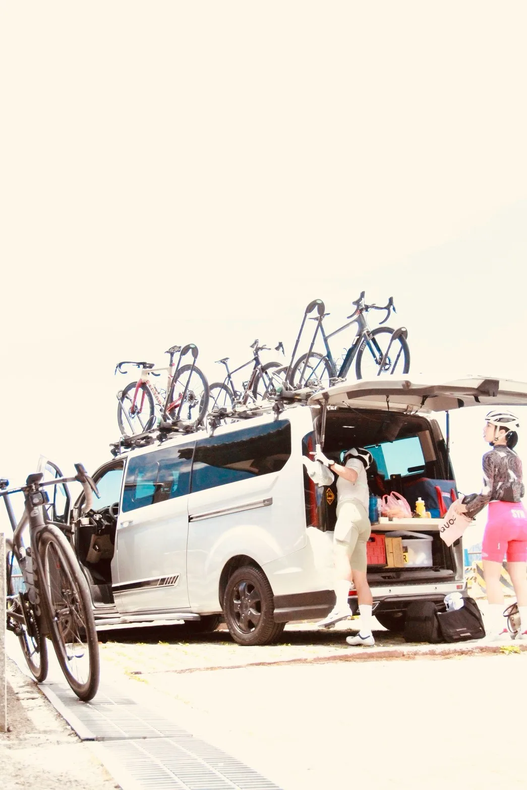
On a route like Wuling, a support vehicle gives you an exit plan if you run out of steam, the weather turns fast, or altitude symptoms show up, so you are not stuck pushing through alone at altitude. It also carries your supplies, cold-weather gear, and luggage so you can ride light and focus on the climb. The fleet has 4 support vehicles, each able to carry up to 8 riders and 8 bikes in a single run; whether it is a solo challenge, a team training camp, or a trip built around an event like the Taiwan KOM Challenge, plans are scaled to your group size, bike count, and days.
A Supported Wuling Day, Finished with Urn-Roasted Chicken
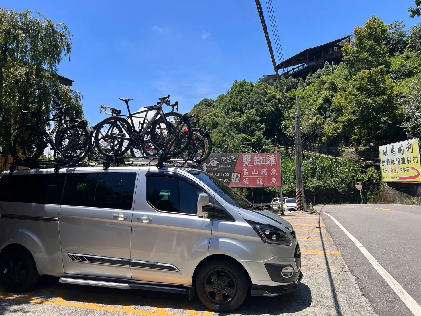
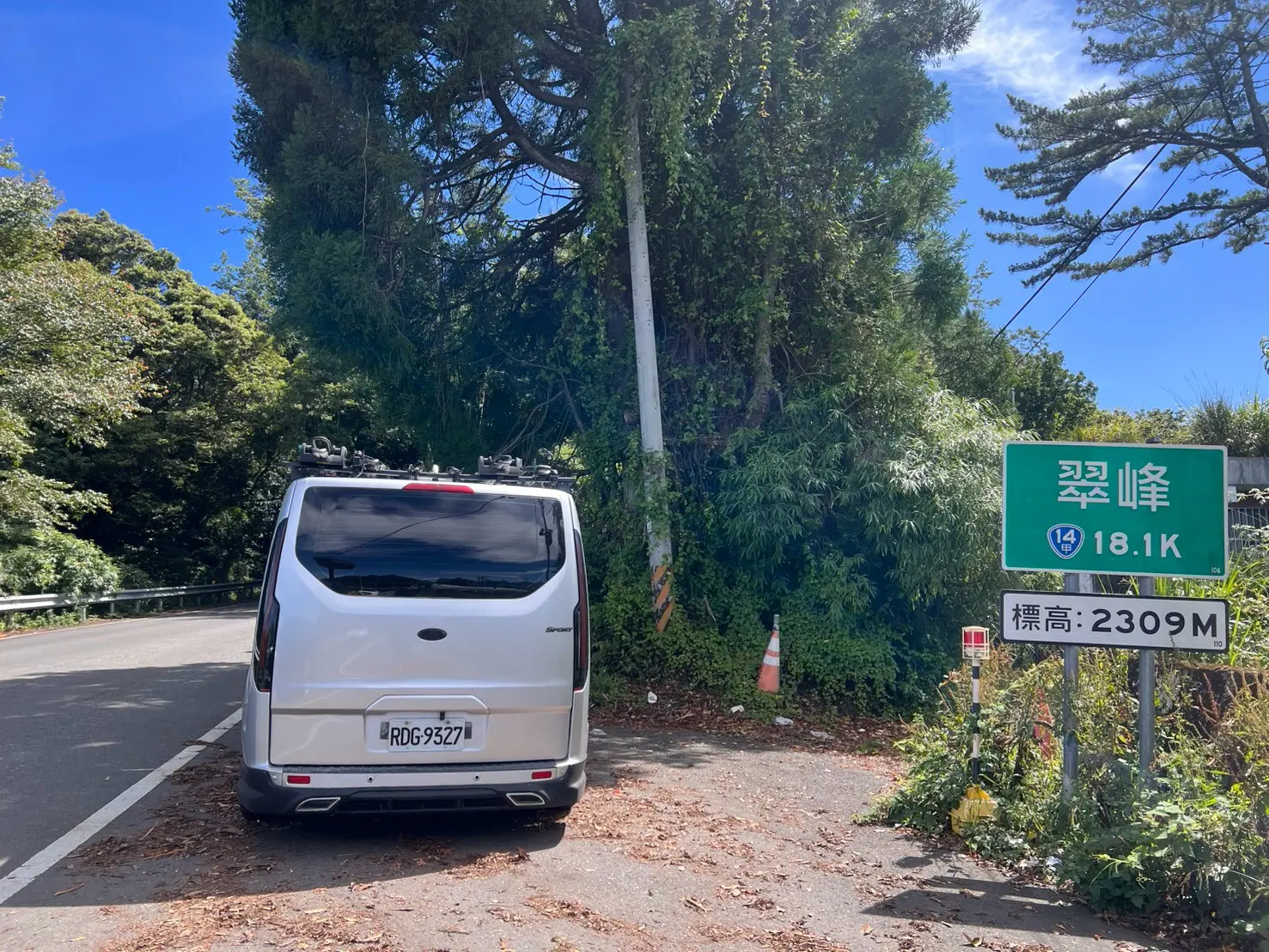
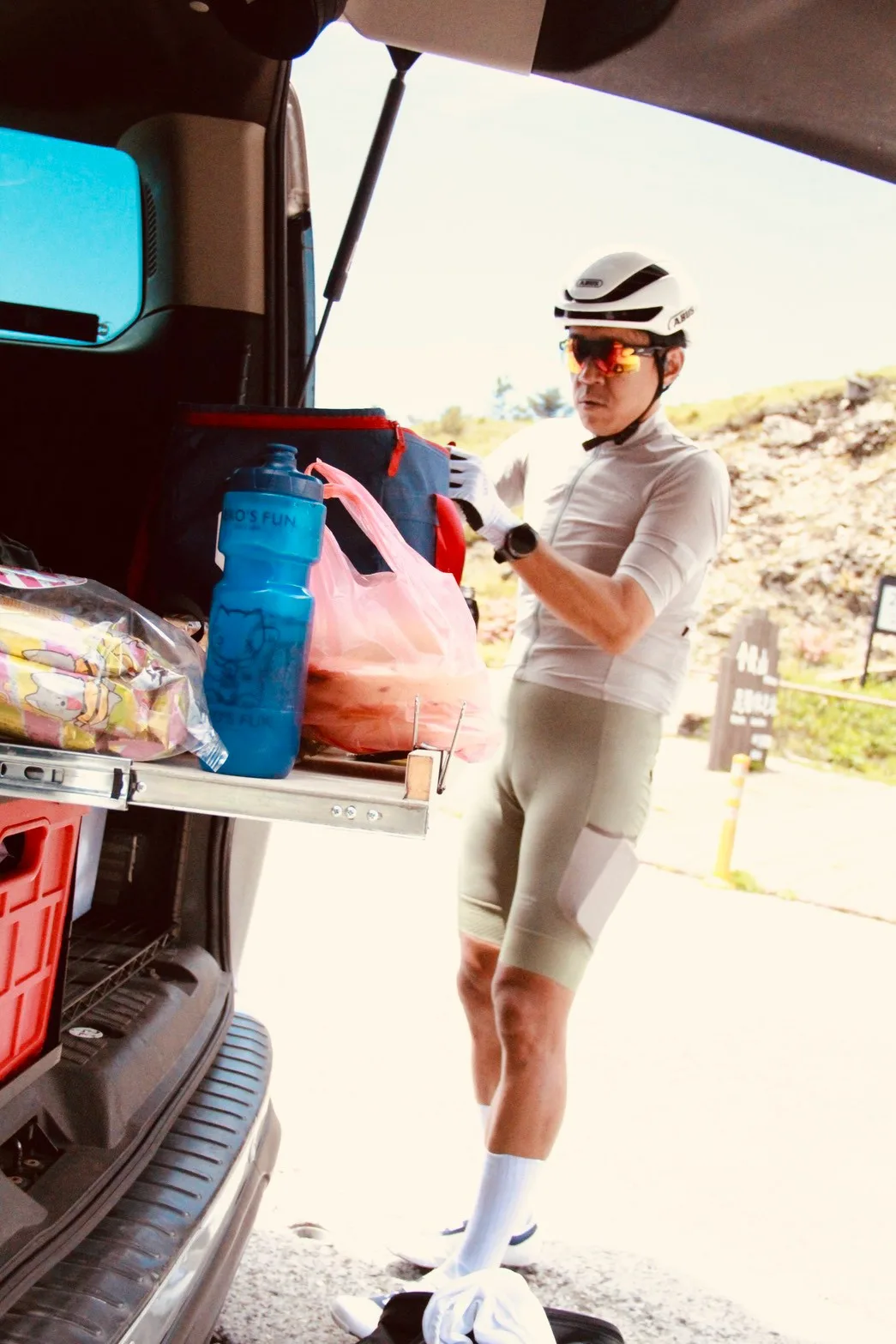
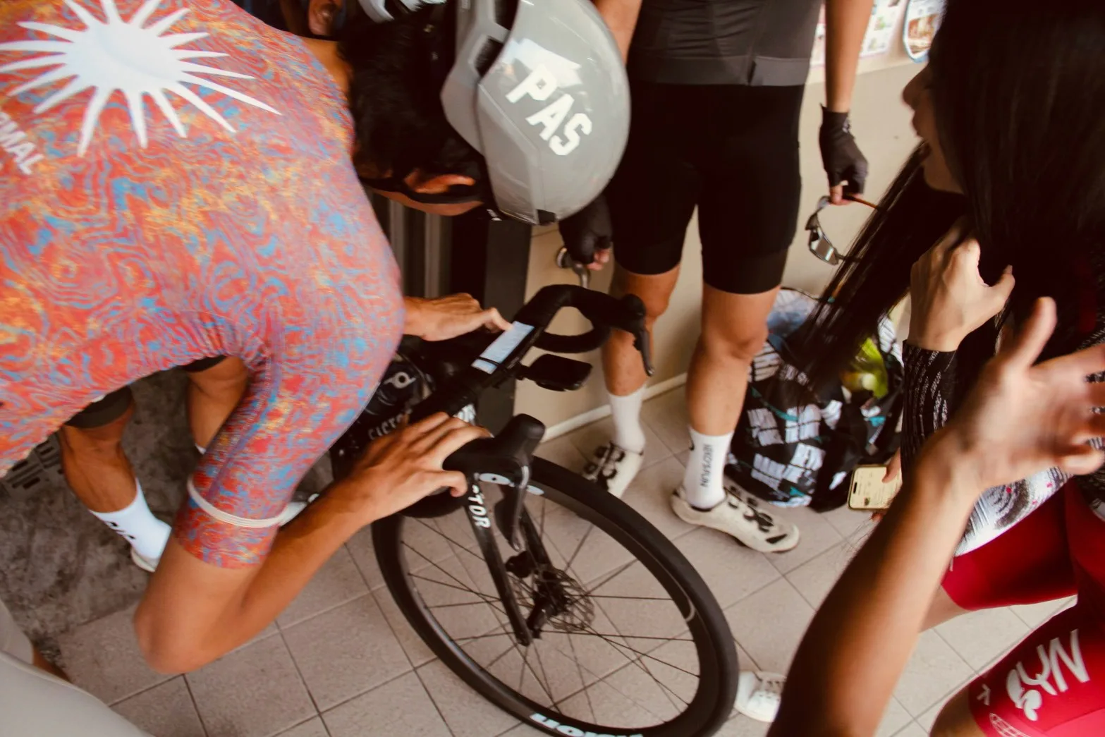
This west-side Wuling ride began in Puli, with the support van carrying bikes, luggage and the equipment needed around the day. The vehicle moved with the group along Highways 14 and 14A while each rider climbed at their own pace. If fatigue, weather or timing changed the plan, the group still had one coordinated way to move riders, bikes and bags together. The photos capture a support stop at Cuifeng, 2,309 meters above sea level, plus real bike checks and roadside logistics.
After the ride, the bikes were loaded and the group sat down at a local restaurant for Taiwanese urn-roasted chicken, or 甕缸雞. A meal stop is not automatically included in every booking, but it can be requested when planning. Send your date, group size, bike count, pickup and drop-off points, and whether you want a post-ride meal; we will confirm feasibility before providing a custom quote.
FAQ
How high is Wuling Pass?
Wuling Pass is 3,275 meters above sea level, around km 31.5 on Provincial Highway 14A, and is the highest point on Taiwan’s highway system.
How long is the Puli to Wuling cycling route?
Starting near the Geographic Center of Taiwan in Puli, the western route is about 53–54 km. Exact distance and elevation gain vary with the chosen start and GPS device.
Is Puli to Wuling the same route as the Taiwan KOM Challenge?
No. The western route climbs from Puli through Wushe, Qingjing, Cuifeng and Kunyang. The classic Taiwan KOM route starts on the Pacific coast in Hualien; both finish at Wuling.
Do I need a support van to cycle Wuling?
It is not mandatory for an independent ride. For groups and visiting cyclists, a support van keeps riders, bikes, luggage and post-ride transport together while preserving an exit option if fitness, weather or timing changes.
Is the post-ride urn-roasted chicken included?
It is not a standard inclusion, but you can request a restaurant stop while planning. The final arrangement depends on the date, route, group size and restaurant availability.
Sources
Rules and road conditions change — always check the official announcements before you travel.
Related guides
- Road Control on the KOM Route: When the Highway Opens and Why You Cannot Ride at Night
- When to Ride Wuling Month by Month, and What 3,275 m Means Where You Come From
- Xianshan KOM Guide|Racing and Reaching Nanzhuang
Need a support vehicle?
Tell us your plan and we will suggest an option based on group size, bike count, and days.