
Guides · Cycling in Taiwan
Taiwan Cycling Route No.1|Distance & Closed Roads
Taiwan's round-island cycling route, officially Cycling Route No. 1, is a long-time goal for many riders visiting Taiwan. A loop that stitches together provincial highways across every county on the island, with two government agencies quoting slightly different total distances, and a handful of sections where bicycles simply aren't allowed. This guide pulls together what the Directorate General of Highways, the Tourism Administration, the Central Weather Administration, and Taiwan Railway have published, so you can plan a route, a direction, and a way to split the ride if riding it in one continuous nine-day push isn't realistic.
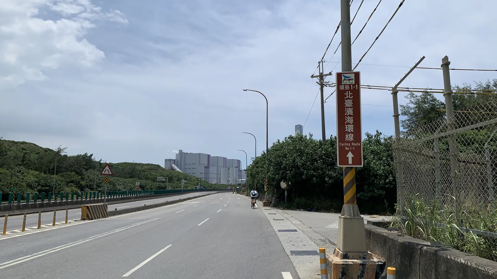
The Official Status of Cycling Route No. 1 and Its Two Distance Figures
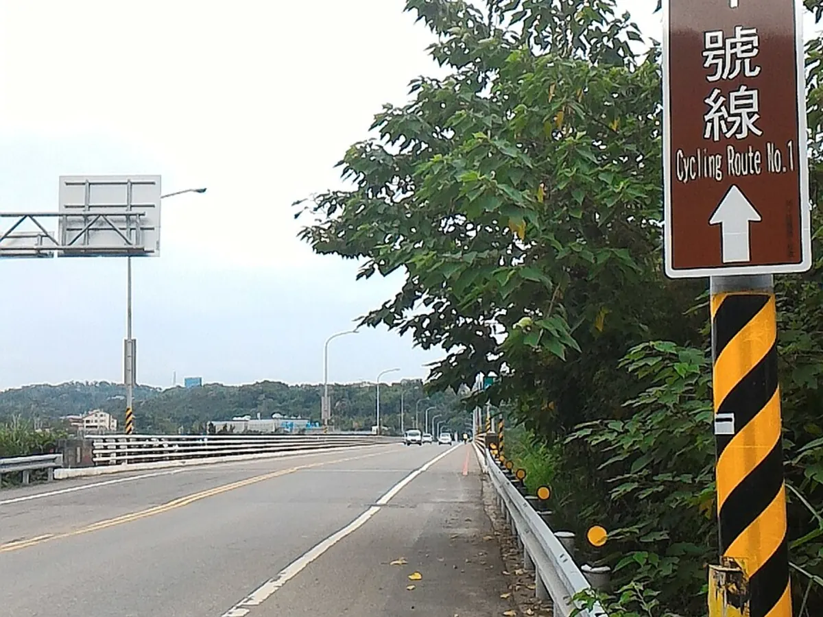
Cycling Route No. 1 is a round-island cycling route planned by Taiwan's Tourism Administration, stitching together provincial highway sections across every county and city on the island. It opened in late 2015, with the Directorate General of Highways publishing a consolidated route announcement the following year, in 2016. The Tourism Administration handles the travel information side, while the Directorate General of Highways is responsible for the provincial highway construction and mileage announcements. And because the two agencies own different parts of the route, they have each published a slightly different total distance.
The Directorate General of Highways lists the main line of Cycling Route No. 1 at 968 km, of which about 929 km (77% of the total) runs along provincial highways, plus roughly 235 km of loop spurs near Nantou and Dapeng Bay, for a combined 1,203 km. The Tourism Administration's Taiwan Bike travel portal, on the other hand, lists the route at 960.8 km. The two figures differ by about 7 km, and no official document explains the gap, so it's worth planning around a range of roughly 960 to 968 km rather than treating either number as the single official value. Both are figures a government agency has actually published.
Where the Route Goes, from the Provincial Highway Backbone to the East Coast Alternatives
The backbone of Cycling Route No. 1 is a chain of provincial highway sections linking every county and city around the island. Per the Directorate General of Highways, provincial highways make up about 77% of the total distance (roughly 929 km), with the rest made up of connector sections and stretches of dedicated cycling path. Beyond the main line, the Highways agency also planned loop spurs near Nantou and Dapeng Bay. About 235 km combined, that let riders detour off the main line toward specific attractions or inland sections; these spurs are counted separately from the 968 km main line.
The east coast is the stretch that needs the most route planning. Highway 9, the Suhua Highway, has long been the main north-south corridor on the east coast, and it has been progressively supplemented by the Suhua Freeway (the mountain-section improvement project for Highway 9), which runs 38.8 km with eight tunnels and was fully opened in January 2020. The Suhua Freeway's long tunnel sections are closed to bicycles, so cyclists use Highway 9D (the surviving stretch of the old Suhua Highway) instead. Further north, between Yilan and Taipei, the Xueshan Tunnel on Freeway No. 5 is closed to bicycles entirely. Riders typically detour via Highway 2, the north coast route, or use Taiwan Railway to skip this section.
Clockwise or Counter-Clockwise? Reading the Monsoon and Typhoon Season
You'll often hear that riding counter-clockwise helps you avoid headwinds on the east coast, but there is no official document from the Directorate General of Highways, the Tourism Administration, or the Central Weather Administration recommending a riding direction for the round-island route. Clockwise and counter-clockwise are both just choices riders make based on their own experience, and neither is an officially endorsed 'correct' answer. What official data does exist covers Taiwan's overall monsoon and typhoon patterns.
According to the Central Weather Administration's official science portal, the northeast monsoon blows from October through the following April. Seven months, peaking from December to February, when the north and northeast tend to see extended rainy stretches. The southwest monsoon runs roughly mid-June through mid-September, peaking in August, and brings pronounced afternoon rain to central and southern Taiwan. Separately, the Central Weather Administration's climate service portal treats June through November as the forecast window for typhoons approaching Taiwan. These three periods overlap, and they're useful as an official baseline for weather risk when picking a month for a round-island trip. But exactly how that translates into a preferred direction or departure month is still a judgment call each rider makes for their own itinerary, not an official recommendation.
Sections That Need Extra Care on the Suhua Highway, Suhua Freeway, and Xueshan Tunnel
On the east coast, the Suhua Freeway (the mountain-section improvement project for Highway 9) runs 38.8 km with eight tunnels, 63% of the route by length. And was fully opened in January 2020. From the start, the Directorate General of Highways posted closure signage at the tunnel entrances. Large motorcycles, motorcycles, and bicycles are not allowed on the freeway's long tunnel sections. The Highways agency's official explanation notes that the enclosed tunnel environment. Air quality, noise, and temperature in long tunnels. Has a negative physical and psychological impact on motorcycle and bicycle riders, and that some tunnels run over 3 km with a single lane shared with large trucks, raising the risk. The official alternative for cyclists is Highway 9D, the surviving stretch of the old Suhua Highway, which the Highways agency designates for 'tourism and leisure' use and keeps open to slow vehicles, motorcycles, and bicycles.
One detail worth knowing. The roughly 5 km 'Heren to Daqingshui' stretch of the old Suhua Highway was formally decommissioned by an Executive Yuan announcement in early 2026, after repeated slope collapses following an earthquake. The replacement is the Suhua Freeway's Renshui Tunnel, which was opened to bicycles and pedestrians as part of that same arrangement. Separately, the Dongao-to-Nan'ao stretch of the old Suhua Highway still carries general traffic, including bicycles, for now, though the safety-upgrade project for that section is still in the design-review stage. Further north, between Taipei and Yilan, the Xueshan Tunnel on Freeway No. 5 is a different case entirely. Under Taiwan's expressway traffic control regulations, slow vehicles (which include bicycles) and motorcycles are barred from freeways outright, with no exceptions. Riders need to route around this section entirely, via Highway 2's north coast route or by using Taiwan Railway. Because these access rules shift with construction progress, it's worth checking the latest notices from the Highways agency's eastern engineering office before you go.
Splitting the Loop with Taiwan Railway's Bike-Friendly Trains
There's no official 'how many days, how many segments' breakdown for Cycling Route No. 1, but the Directorate General of Highways' route announcement explicitly mentions the concept of riding it in stages. The route is designed with spur connections to Taiwan Railway stations, so riders who can't finish the loop in one continuous push can use Taiwan Railway's bike-friendly trains to complete it over multiple trips. Several sources point to about nine days as a common planning benchmark for finishing the main line. A rule of thumb riders use, not a fixed itinerary published by the Highways agency or the Tourism Administration. Certified rest stops are spaced every 15 to 20 km along the route for resupply on the longer stretches.
Taiwan Railway offers three ways to bring a bike aboard. The first is the free bike-bag method. Pack the bike fully into a bag that meets the size limits (no longer than 150 cm, and no more than 220 cm combined length + width + height), and it can ride on any train at no extra charge. Though Taiwan Railway may suspend this during long holiday weekends. The second is the dedicated bike-friendly service, where the bike rolls straight into the carriage without being disassembled or bagged, at half the adult fare. But only on designated express trains (eight services are listed in the official schedule), tickets must be bought at a station counter rather than online, and each departure has a limited bike quota; this group/charter service is suspended during holidays of three or more consecutive days, though regular bike-bag travel continues as usual. The third option is formal baggage check-in, available whether or not the bike is bagged, at NT$20 per 10 km with a NT$60 minimum, handled at stations with a baggage counter. Together, these options let riders split a round-island trip into stages, hopping a train past a section they'd rather skip or don't have time for, instead of riding the entire loop in one continuous push.
Where a Support Vehicle Fits Into a Round-Island Trip
A round-island trip runs for days, and each day means recalculating distances, resupply points, and where to sleep. Carrying all your luggage, spare parts, and gear on the bike itself takes a real toll over that many days in the saddle. And on stretches like the Suhua Freeway or the Xueshan Tunnel, where bicycles simply aren't allowed or aren't advisable, you need a vehicle to shuttle riders and bikes past that section before picking the route back up. 24EZGO has supported cycling events and race logistics since 2020. Seven years of hands-on experience, typically 10 to 20 events a year, more than 3,000 riders served, a fleet of four support vehicles, and capacity for up to 8 riders and 8 bikes in a single dispatch.
On a round-island trip, a support vehicle can follow your planned route and schedule day by day, carrying luggage and supplies, and shuttling riders and bikes past sections closed to bicycles. Like the Suhua Freeway or the Xueshan Tunnel. So you can pick the route back up on the other side. Whether you're going clockwise or counter-clockwise, or splitting the trip with Taiwan Railway along the way, the daily pickup points and shuttle plan can be adjusted to match. If you're planning a trip to take on Cycling Route No. 1, tell us your planned days, direction, and which sections need a shuttle, and we'll put together a support plan for the actual itinerary.
Sources
- 交通部公路局(公路總局), 自行車環島1號線公告
- 交通部公路局, 蘇花改公路未開放機車通行說明
- 交通部公路局 蘇花改工程處
- 全國法規資料庫, 高速公路及快速公路交通管制規則
- 交通部中央氣象署, 數位科普網
- 交通部中央氣象署, 氣候服務入口網
- 臺灣鐵路公司, 兩鐵列車(對號列車)
- 臺灣鐵路公司, 兩鐵列車(非對號/區間車)
Rules and road conditions change — always check the official announcements before you travel.
Related guides
- Riding Between Company Branches, and How the Support Vehicle Is Arranged
- When to Ride Wuling Month by Month, and What 3,275 m Means Where You Come From
- Cycling Central Taiwan from Taichung|Sun Moon Lake and Wuling Day Rides
Elsewhere in the ecosystem
- siokiu · Group RidesTaiwanese for "let's go together", where local riders post routes and gather for weekend rides
- gear · Bike Maintenancereads your Strava mileage and works out when chains, tyres and pads are due
Need a support vehicle?
Tell us your plan and we will suggest an option based on group size, bike count, and days.